Key Takeaways
- Cargo tracking satellite imagery provides independent verification of vessel positions and terminal activity beyond self-reported AIS data.
- Advanced earth observation tools allow analysts to measure bulk cargo stockpiles and evaluate real-time port congestion from space.
- Data latency, cloud interference, and procurement costs remain primary technical limitations for widespread commercial adoption.
Integrating advanced remote sensing and earth observation tools into maritime logistics is transforming how maritime operators evaluate terminal activity and port performance. Modern supply chain visibility increasingly relies on cargo tracking satellite imagery alongside dry bulk chartering strategies and traditional tracking systems to enhance operational awareness and reduce unforeseen voyage risks across global trade lanes.
The Shift Towards Remote Maritime Observation
Traditional vessel monitoring relies primarily on Automatic Identification Systems. However, transponders can occasionally be switched off or manipulated during transit, creating operational blind spots for charterers and port authorities alike. By deploying cargo tracking satellite imagery, analysts can independently verify vessel positions, draft changes, and berth activity without depending solely on self-reported data feeds.
Monitoring Bulk Cargo Stockpiles Using Cargo Tracking Satellite Imagery
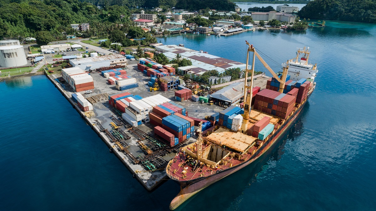
Optical and radar sensors allow operators to continuously monitor raw material stockpiles at major terminals globally. By measuring shadow lengths, volumetric changes, and surface area variations over time, geospatial analysts can accurately quantify inventory volumes for essential commodities such as iron ore, coal, and grain. This capability provides independent insights into regional trade flows, complementing broader tonnage supply trends observed across major bulk sectors while helping stakeholders verify local inventory drawdowns.
Analysing Port Congestion from Space
Port congestion analytics benefit significantly from frequent satellite passes over key maritime hubs. High-resolution synthetic aperture radar can penetrate adverse weather and heavy cloud cover to count vessels waiting at anchorages and active berths, mapping waiting times and operational bottlenecks with high precision. This offers charterers and maritime traders a distinct competitive advantage when assessing terminal efficiency.
Technical Limitations and Challenges
Despite technological advancements, practical constraints remain in everyday application. Persistent cloud interference can occasionally obscure optical sensors, while processing delays and data latency can impact rapid, real-time decision-making. Furthermore, procuring high-resolution commercial imagery involves substantial financial cost, requiring shipping firms to carefully balance analytical depth against operational budgets.
Commercial Applications for Analysts
Commodity traders use these remote sensing datasets to anticipate market movements and supply shifts well before official port authority figures are published. By tracking physical stockpile accumulation and discharge rates, commercial teams gain verified metrics to inform voyage planning, optimise fleet deployment, and strengthen strategic charter party negotiations.
Final Thoughts
Earth observation data has matured from a supplementary monitoring tool into a core component of modern maritime intelligence. As sensor resolutions improve and revisit rates increase across constellations, remote monitoring will play an even greater role in commercial shipping decisions aligned with IMO maritime standards and guidance.